A new interactive map created by Victory Logistics District reveals the most comprehensive visual to date of Fernley’s largest industrial development and its growing impact on the future of the city.
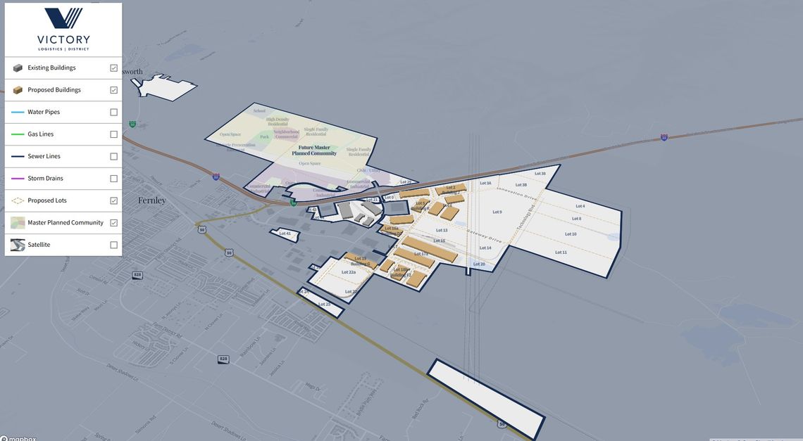
The map, developed in collaboration with Cartifact, allows users to explore the entire Victory footprint by toggling layers that show existing and proposed buildings, utility lines, and even a planned residential community north of the industrial zone.
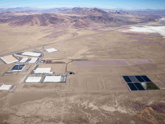
At a glance, the scale is impressive. The Victory site stretches from the core industrial park just north of Highway 50, weaving past Fernley’s existing neighborhoods and reaching out toward I-80. Existing buildings are already clustered along the rail line, while proposed lots hint at future phases of expansion, many of which are already in active planning stages.
But it isn’t just all about building warehouses. The layered map reveals water, gas, sewer, and storm infrastructure already in place, or in progress, which positions the district as a turnkey site for manufacturing, logistics, and innovation. Strategic infrastructure that makes Fernley a highly desirable location.
And just beyond the industrial core, the map shows what Victory has referred to as a “future master planned community,” a residential area designed to support the workforce needed for a thriving logistics economy. It includes designated places for schools, open space, neighborhood commercial centers, and a mix of housing densities.
This isn’t just a developer's dream, it’s a roadmap for regional transformation. By offering a publicly accessible, real-time visualization of the district’s buildout, Victory is providing a level of transparency not always seen in private development.
It also gives residents and business owners a chance to see how all the puzzle pieces fit together. Whether you’re a contractor eyeing infrastructure projects, a small business wondering where new customers may come from, or a resident curious about what’s going in on the east side of town, the map provides answers.
The interactive tool which is hosted at maps.cartifact.com/markiv/victory is expected to be updated as new projects come online, making it a dynamic reference point not just for developers and engineers, but for Fernley’s community at large. Use this QR code to go directly there.



Comment
Comments