
TCID manager says canal erosion poses no threat
Robert Perea, The Fernley Reporter
When forecasters began to predict flooding in the Fernley area before last weekend’s major storm, many Fernley residents, recalling the flooding in 2008, began to cast a wary eye toward the Truckee Carson Irrigation District canal.
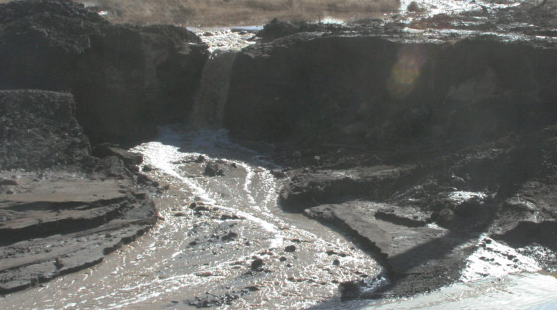
For many, that concern turned to fear when they saw the southern bank of the canal eroded in several areas near Miller Lane, with water pouring in.
However, TCID District Manager and General Counsel Rusty Jardine says the areas of erosion on the canal’s southern bank poses no threat to property owners near the canal.


Jardine said the erosion of the canal’s southern embankment was caused by flood water coming from the south, and that water running into the canal prevented the flooding from being worse.
The canal was nearly empty at the time, Jardine said, because TCID had stopped diverting Truckee River water into the canal.
Jardine said TCID monitored the canal throughout the weekend of Jan. 7 and 8 because of the forecasts of flooding, and because of extremely high flows in the Truckee River.
“Sunday night we met with the city manager and mayor and coordinated our efforts,” he said. “We had a lot of eyes on the Truckee canal.”
Jardine said the district’s biggest concern on the Truckee River was protecting Derby Dam, where the river was flowing in excess of 18,000 cubic feet per second. By comparison, Jardine said, it’s not unusual for flows this time of year to be 2,000 to 3,000 CFS.
“In 1997 during the great flood it was flowing at 23-25,000 CFS, so this was a significant event,” Jardine said. “To protect the dam from any kind of damage, we were able to remove the soft plug.”
Jardine said the soft plug is essentially a dirt embankment that can be removed to allow water to spill from the river channel, and alleviate flooding concerns downstream.
He said the district was able to shut off flow into the canal because Lahontan Reservoir already has in excess of 100,000 acre feet of water, with the rest of the lake’s capacity still up in the mountain snowpack.
Although there was flooding occurring near Pyramid Lake in the Sutcliffe area, Jardine said the district was not able to divert more water to reduce flows toward Pyramid Lake because it had already met its limit under federal guidelines.
“We have no right to divert that water, and it goes on to Pyramid Lake as a matter of priority,” he said.
Jardine said TCID received numerous phone calls from residents concerned about seeing flood water eroding the bank of the canal, and he said the district will immediately begin making repairs.
“We won’t have the need to divert into the canal through the end of the month,” he said. “That gives us time to make corrections. But even if we had to divert we could, because the south embankment doesn’t expose itself as a danger to any kind of home.”
Thx u TCID & The City Manager & Mayor